· Posts · 1 min read
Spatial Data Declustering in Python

import geolime as geo
drillholes = geo.read_file(
"rocklea_dh.geo"
)
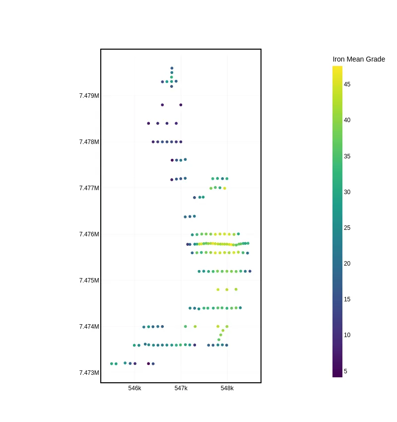
drillholes.plot_2d(
attribute="Fe",
agg_method="mean"
)
geo.moving_window_declus(
obj=drillholes,
obj_attribute="Fe",
declus_attribute="Fe_declus_weight_mw",
diam_x=500,
diamy=500,
geometry='BALL'
)
geo.cell_declustering(
obj=drillholes,
obj_attribute="Fe",
declus_attribute="Fe_declus_weight_cd",
size_x=500,
size_y=500,
nb_off=25
)
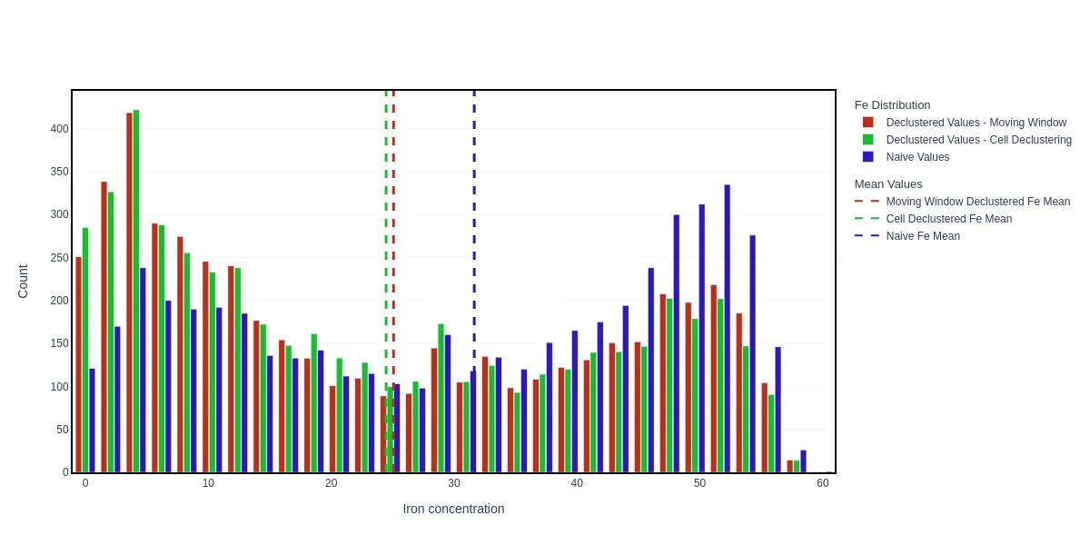
geo.bar(
[
{"objects": dh, "property": "Fe"},
{
"objects": drillholes,
"property": "Fe",
"weights": "Fe_declus_weight_mw"
},
{
"objects": drillholes,
"property": "Fe",
"weights": "Fe_declus_weight_cd"
},
],
nbins=30
)
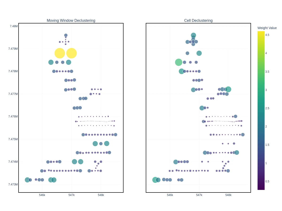
geo.plot_2d(
    [
        {
            "objects": drillholes,
            "property": "Fe_declus_weight_mw",
            "size": "Fe_declus_weight_mw"
            "title": "Moving Window Declustering"
        },
        {
            "objects": drillholes,
            "property": "Fe_declus_weight_cd",
            "size": "Fe_declus_weight_cd"
            "title": "Cell Declustering"
        },
    ],
    yaxis_shared=True,
    colorscale_name="Weight Value"
)