· Posts · 1 min read
GIS Selection & Polygon Exclusion

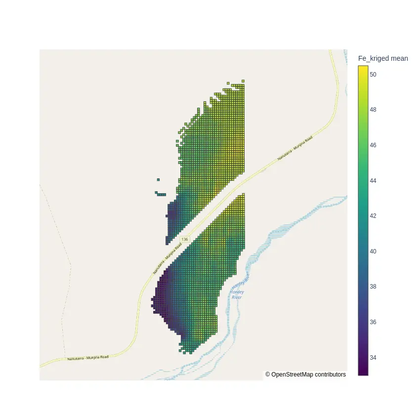
Do you have natural constraints in your deposit zone?
OpenStreetMap’s freely available data makes it easy to select specific features and convert them into GeoLime objects. Using their GIS digitization is a simple way to eliminate inaccessible areas.
Rocklea Dome is crossed by an Highway road bounded by the Hardey River.
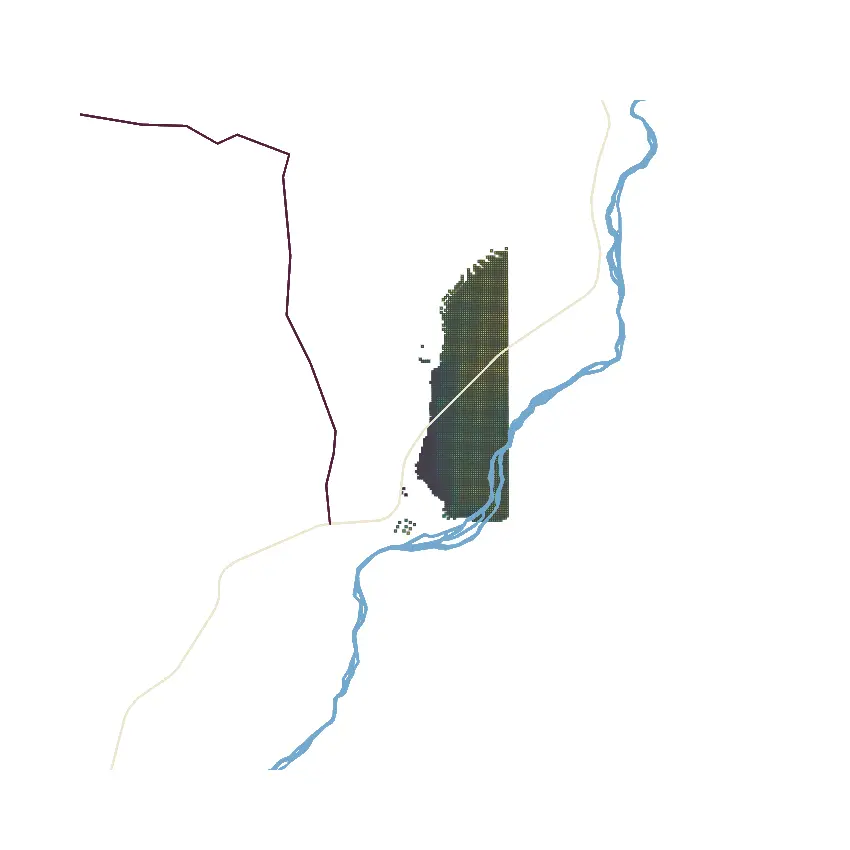
Using geolime makes it easy to remove the block lyiing in these constraints.
geo.select_points_inside_polygon(
    gis_object=hardey_river,
    object_to_select=block_model,
    property_name='in_river'
    )
geo.select_points_inside_polygon(
    gis_object=highway_road,
    object_to_select=block_model,
    property_name='in_road'
    )
block_model.delete_cells('in_river')
block_model.delete_cells('in_road')
Check out GeoLime documentation for more details.